Geodetic Network
Establishing a geodetic reference of the 3D model
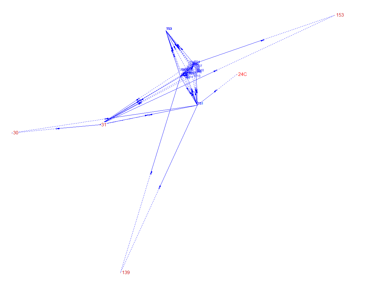
In order to georeference the whole model a small geodedic network measurement was conducted. From the GIS Graubünden the position and the coordinates of fixpoints in the swiss coordinate system LV95 could be extracted. Several setups around the chapel where needed to capture all targets and features from the outside and inside that are also visible in the laser scans and photogrammetric acquisitions.
Processing
The main processing was done in the Software CAPLAN. There approximate coordinates were calculated by performing a free network adjustment. The final coordinates could then be computed through a 7-parameter Helmert transformation.